REFERENCE INFORMATION
ELEV 2700'
S21°13’46’’ E014°52’03’’
UIS
FYUS
Uis Traffic
(unmanned)
124.8
Windhoek Info
(above 2000' AGL)
124.7
ATIS
NIL
RWYS
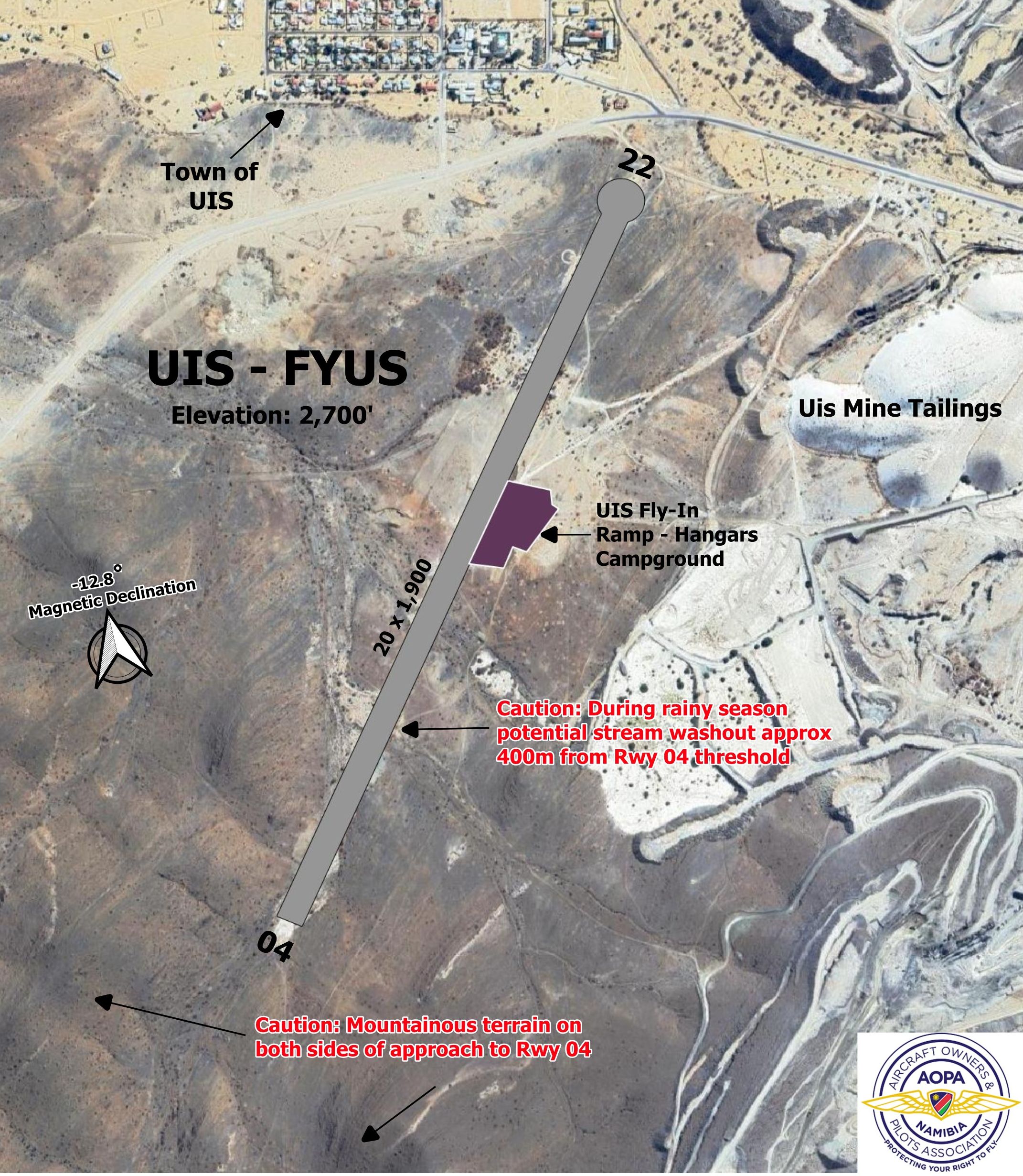
04/22 - (1,900 m x 20 m)
---
AERODROME CHARTS

CIRCUITS
RWY 04/22 - Left or Right hand - Circuit altitude 3,700’ AMSL.
CAUTIONS
1. Brandberg Mountains approx. 10 nm West of field.
2. Hills on both sides of approach, especially when landing 04.
3. River on western side of RWY can create washouts; take care in rainy season.
4. RWY is 1900 m long, but only 1500 m appears usable due to river washout ~400 m from 04 threshold.
5. Uis mine exists on east side of the airfield.
LANDING INSTRUCTIONS
Uis mine has Radio; try to raise on 124.8 before landing.
FACILITIES
OPERATOR
Uis Mine
SUPPLEMENTARY
Nil specifics.

